
Construction Drone Mapping Atlanta
Cut/fill reports, stockpile volumes, grade verification, and construction progress drone photography — survey-grade orthomosaic drone services for Atlanta Metro contractors and developers.
Why Atlanta Contractors Choose Us
Accurate Earthwork Data Before the First Shovel Moves
Earthwork is one of the highest-risk line items on any Atlanta construction budget. Underestimating cut/fill volumes or relying on outdated topo data can turn a profitable job into a loss before the first subcontractor mobilizes.
Brown's Aerial Photography gives Atlanta estimators and project managers defensible quantity data from pre-bid through final as-built — cut/fill reports, stockpile volumes, and existing grade models that reflect actual site conditions, not assumptions.
We're based in Cartersville — 45 minutes from downtown Atlanta — and serve contractors, developers, and civil engineering firms across Fulton, Cobb, Gwinnett, Cherokee, and surrounding counties.
Get a Project Quote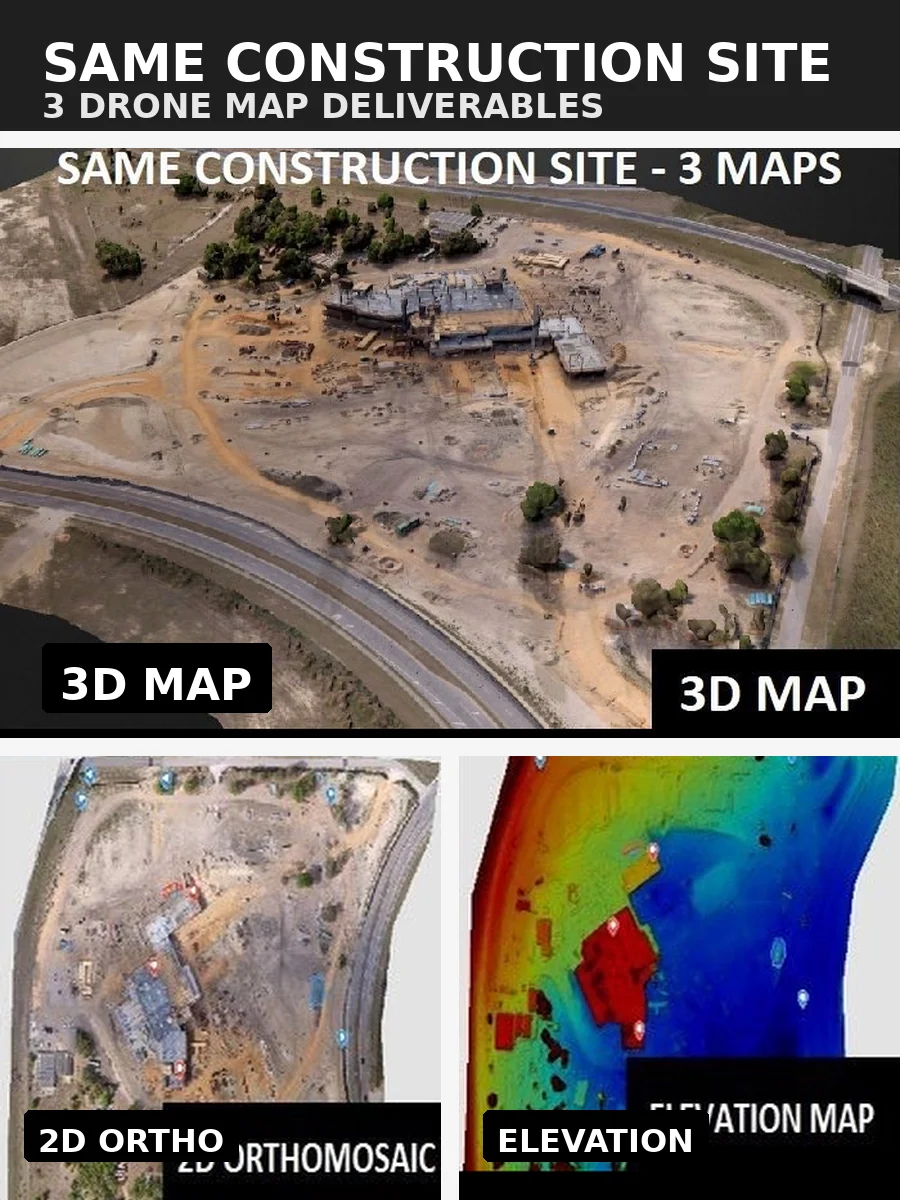
3 Deliverables — Same Atlanta Construction Site
3D map · 2D orthomosaic · Elevation map
What We Deliver
Survey-Grade Orthomosaic Drone Services for Atlanta Projects
Every deliverable is formatted for your workflow — Civil 3D, AutoCAD, and standard project management platforms.
Cut/Fill Reports
Color-coded difference maps quantifying material to cut and fill across the entire site — formatted for Civil 3D and AutoCAD.
Stockpile Volume Calculations
Measure dirt, aggregate, and material piles to within 1–3% accuracy for cost estimating and inventory tracking.
Grade Verification
Compare as-built grades against design plans before paving or concrete crews mobilize — catch problems early.
Existing Conditions Survey
Establish accurate baseline grades before earthwork begins — the foundation your estimate depends on.
As-Built Documentation
Confirm finished grades match design tolerances and produce a permanent record for owner closeout.
Progress Photography
Weekly or milestone-based aerial captures with date-stamped, georeferenced records for lender draws and owner reporting.
Real Deliverables
Sample Work from the Field
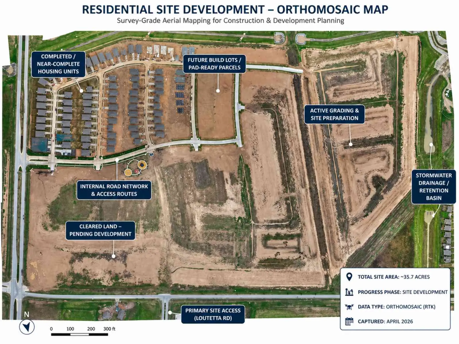
Residential Site Development — Orthomosaic Map
Survey-grade aerial mapping · 35.7 acres · RTK data
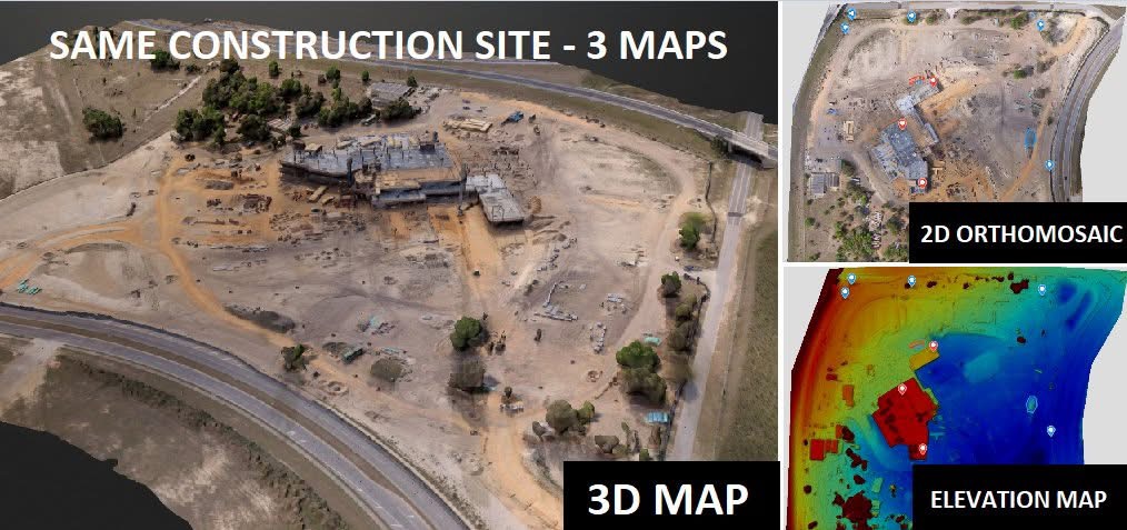
3D Map + Orthomosaic + Elevation — Side by Side
Multi-deliverable comparison · Construction progress documentation
Atlanta Metro Service Area
Counties We Serve
Based in Cartersville, GA — we serve the entire Atlanta Metro and surrounding counties. Call us to confirm coverage for your project location.
Common Questions
Atlanta Construction Drone Mapping FAQ
How accurate are your cut/fill volume calculations?
Our drone-derived surface models are accurate to within 1–3% for stockpile volumes and earthwork quantities — comparable to traditional survey methods at a fraction of the cost and time.
What file formats do you deliver?
We deliver orthomosaics (GeoTIFF), point clouds (LAS/LAZ), surface models (DXF, DWG), and PDF reports. All outputs are formatted for Civil 3D, AutoCAD, and standard project management platforms.
How quickly can you mobilize for an Atlanta-area project?
We typically mobilize within 24–48 hours for Atlanta Metro projects. We're based in Cartersville — 45 minutes from downtown Atlanta — so response time is fast.
Can you set up a recurring flight schedule?
Yes. We work with your project schedule to establish weekly, bi-weekly, or milestone-based flights aligned with your reporting and draw inspection needs.
Get Started
Ready to Map Your Atlanta Project?
We respond to most requests within a few hours. Submit a request or call us directly — we're ready to mobilize.