

Industry
Construction
Aerial mapping, progress documentation, and 3D surveys that keep your project on track.
Why Drone Data
Built for Construction Teams
Construction projects move fast. Brown's Aerial Photography gives project managers, owners, and engineers the aerial data they need to stay ahead — accurate site surveys, progress documentation, and 3D deliverables that integrate directly into your workflow.
Progress Documentation
Weekly or milestone-based aerial captures that give owners and PMs a clear picture of site progress without boots on the ground.
Accurate Site Surveys
Survey-grade orthomosaics and point clouds for earthwork verification, grading checks, and volume calculations.
3D Models & CAD Deliverables
Photogrammetry-based 3D models ready for BIM integration, clash detection, and design coordination.
Contractor Accountability
Timestamped aerial records that verify contractor work and protect owners from disputes.
Safety & Risk Reduction
Inspect hard-to-reach areas — rooftops, scaffolding, excavations — without putting personnel at risk.
Fast Turnaround
Deliverables within 48 hours so your team can make decisions without delays.
Real Deliverables
Sample Work from the Field
Actual drone data deliverables produced for construction and development projects — orthomosaics, elevation maps, plant health analysis, and 3D models.
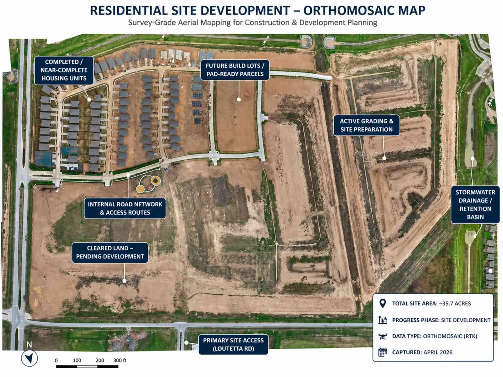
Residential Site Development — Orthomosaic Map
Survey-grade aerial mapping · 35.7 acres · RTK data · April 2026
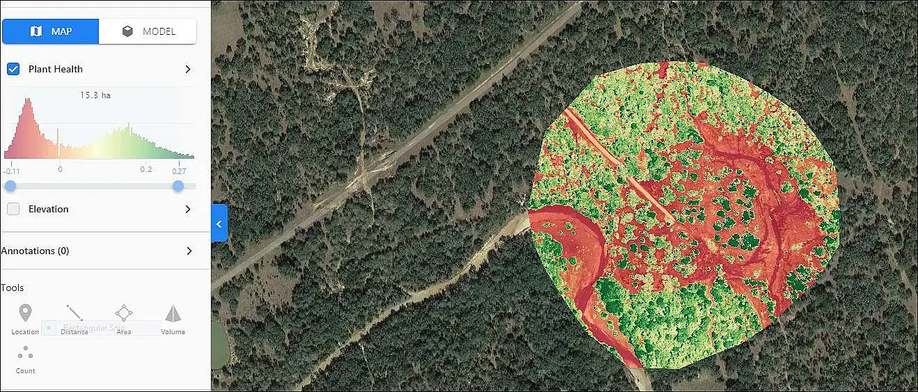
Plant Health & NDVI Analysis
Vegetation index mapping · Site environmental assessment
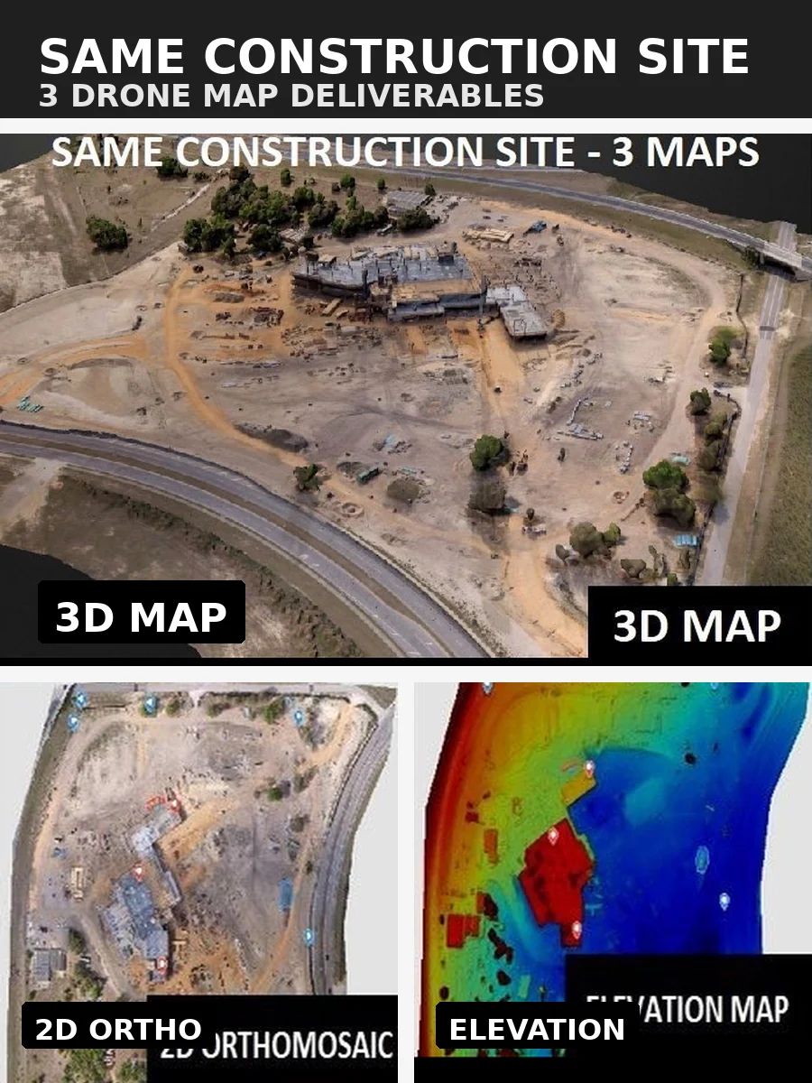
3 Deliverables — Same Construction Site
3D map · 2D orthomosaic · Elevation map
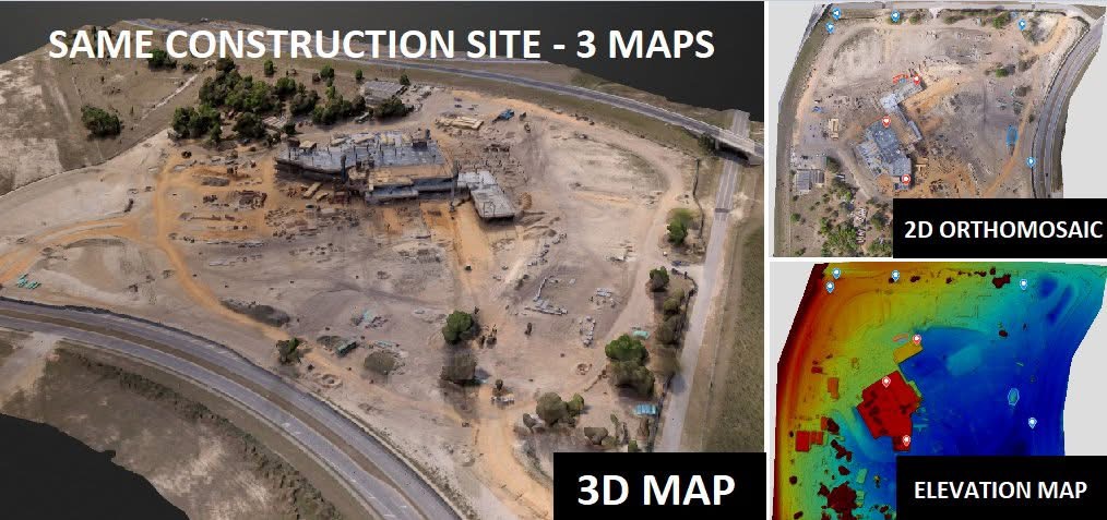
3D Map + Orthomosaic + Elevation — Side by Side
Multi-deliverable comparison · Construction progress documentation
Applications
Common Use Cases
From ground-up commercial builds to infrastructure projects, our drone services adapt to your project type and schedule.
Ready to Elevate Your Project?
Get in touch for a custom quote tailored to your construction project's scope and schedule.