
Construction Documentation Drone Services — Kennesaw, GA
Weekly progress photography, cut/fill reports, grade verification, and as-built surveys for Kennesaw contractors and developers. FAA Part 107 certified — based 20 minutes away in Cartersville.
Why Kennesaw Contractors Choose Us
The Construction Record Your Project Depends On
Kennesaw and Cobb County are in the middle of one of the most active construction cycles in the Atlanta Metro. Commercial development along Barrett Parkway, residential subdivisions in the I-75 corridor, and mixed-use projects near Town Center are all generating demand for accurate, defensible project documentation.
Brown's Aerial Photography provides Kennesaw contractors and developers with the aerial documentation programs that protect schedules, support lender draws, and resolve disputes before they become litigation — weekly progress photography, cut/fill reports, grade verification, and as-built surveys delivered in formats your team can actually use.
We're based in Cartersville — about 20 minutes north on I-75 — which means fast mobilization and consistent coverage throughout your project lifecycle.
Get a Project Quote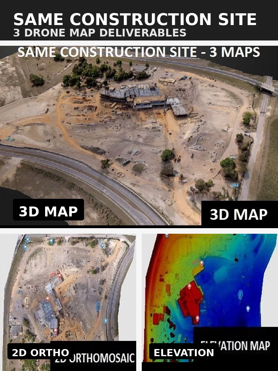
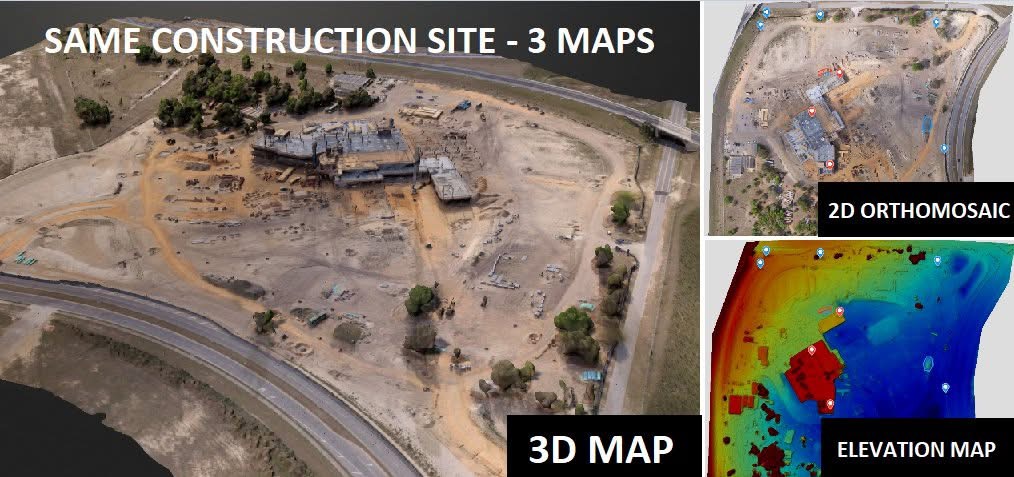
3 Deliverables — Same Construction Site
3D map · 2D orthomosaic · Elevation map
Progress Documentation — Week Over Week
Georeferenced · Date-stamped · Dispute-ready
The Business Case
Documentation That Pays for Itself
A single construction dispute — over schedule delays, changed conditions, or subcontractor scope — can cost more to litigate than the original contract value. Weekly aerial documentation creates a contemporaneous record that is difficult to argue with.
Lenders and owners who require draw inspection support are finding that drone-derived progress documentation provides the independent verification they need — faster and at lower cost than traditional inspection methods.
For Kennesaw projects with active earthwork, drone-derived volumetric data supports pay applications with cut and fill quantities accurate to within 1–3% of traditional survey methods — produced in hours, not days.
What We Deliver
Construction Documentation Services for Kennesaw Projects
Every deliverable is formatted for your workflow — Civil 3D, AutoCAD, and standard project management platforms.
Weekly Progress Documentation
Date-stamped, georeferenced aerial captures on a schedule tied to your project milestones — formatted for lender draws, owner reporting, and dispute resolution.
Cut/Fill Reports
Color-coded difference maps quantifying material to cut and fill across the entire site — formatted for Civil 3D and AutoCAD.
Stockpile Volume Calculations
Measure dirt, aggregate, and material piles to within 1–3% accuracy for cost estimating and inventory tracking.
Grade Verification
Compare as-built grades against design plans before paving or concrete crews mobilize — catch problems early and avoid costly rework.
Existing Conditions Survey
Establish accurate baseline grades before earthwork begins — the foundation your estimate and schedule depend on.
As-Built Documentation
Confirm finished grades match design tolerances and produce a permanent record for owner closeout and warranty documentation.
Kennesaw & Surrounding Area
Cities and Counties We Serve
Based in Cartersville, GA — we serve Kennesaw and the entire Northwest Atlanta Metro corridor. Call us to confirm coverage for your specific project location.
Common Questions
Kennesaw Construction Documentation FAQ
How close is Brown's Aerial Photography to Kennesaw?
We're based in Cartersville — about 20 minutes north of Kennesaw on I-75. We can typically mobilize for Kennesaw-area projects within 24 hours.
How accurate is drone-based construction documentation?
Our drone-derived surface models are accurate to within 1–3% for earthwork volumes — comparable to traditional survey methods at a fraction of the cost and time. Progress photography is georeferenced and date-stamped for legal defensibility.
Can you set up a recurring flight schedule for a Kennesaw project?
Yes. We work with your project schedule to establish weekly, bi-weekly, or milestone-based flights aligned with your reporting and draw inspection needs. Most Kennesaw-area clients run weekly or bi-weekly programs.
What file formats do you deliver?
We deliver orthomosaics (GeoTIFF), point clouds (LAS/LAZ), surface models (DXF, DWG), and PDF reports. All outputs are formatted for Civil 3D, AutoCAD, and standard project management platforms.
Get Started
Ready to Document Your Kennesaw Project?
We respond to most requests within a few hours and can mobilize to Kennesaw within 24 hours. Submit a request or call us directly.